High-quality atmospheric measurements—anywhere you need them
We develop lightweight radiosondes for weather balloons and versatile sensor systems for UAVs, providing precise atmospheric data directly from the field.
Our systems help researchers, environmental teams, and tactical operators measure wind, temperature, humidity, pressure, gases, particles, and other key parameters—especially in places where traditional equipment can’t operate effectively.
What makes Sparv products your most reliable partners

Small and easy to deploy
Carry and launch multiple units with minimal effort. Our ultra-light form factor simplifies field logistics—whether you’re in the lab, in remote environments, or operating under time pressure.

Sustainable by design
Our radiosondes are reusable, built from materials that reduce environmental impact, and engineered to fly with less helium—a finite resource.
These lightweight systems support everything from atmospheric research to extreme-weather missions while leaving a smaller footprint.

Reliable technology you can trust
Built for accuracy and long-term stability, our systems provide reliable measurements with minimal downtime, even in challenging field conditions.
Products & Services
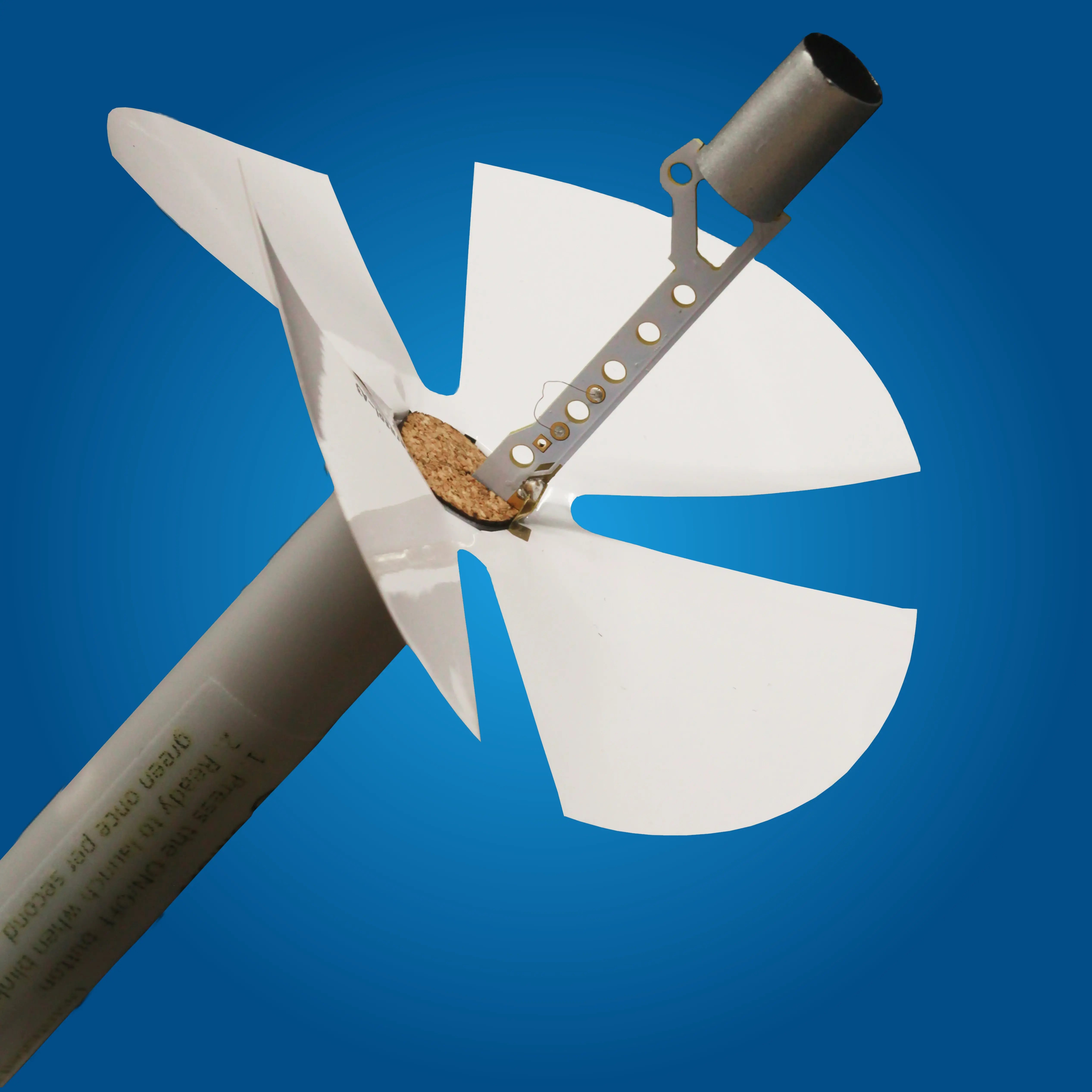
Windsond S2 - Ultra-light radiosondes for better field operations.
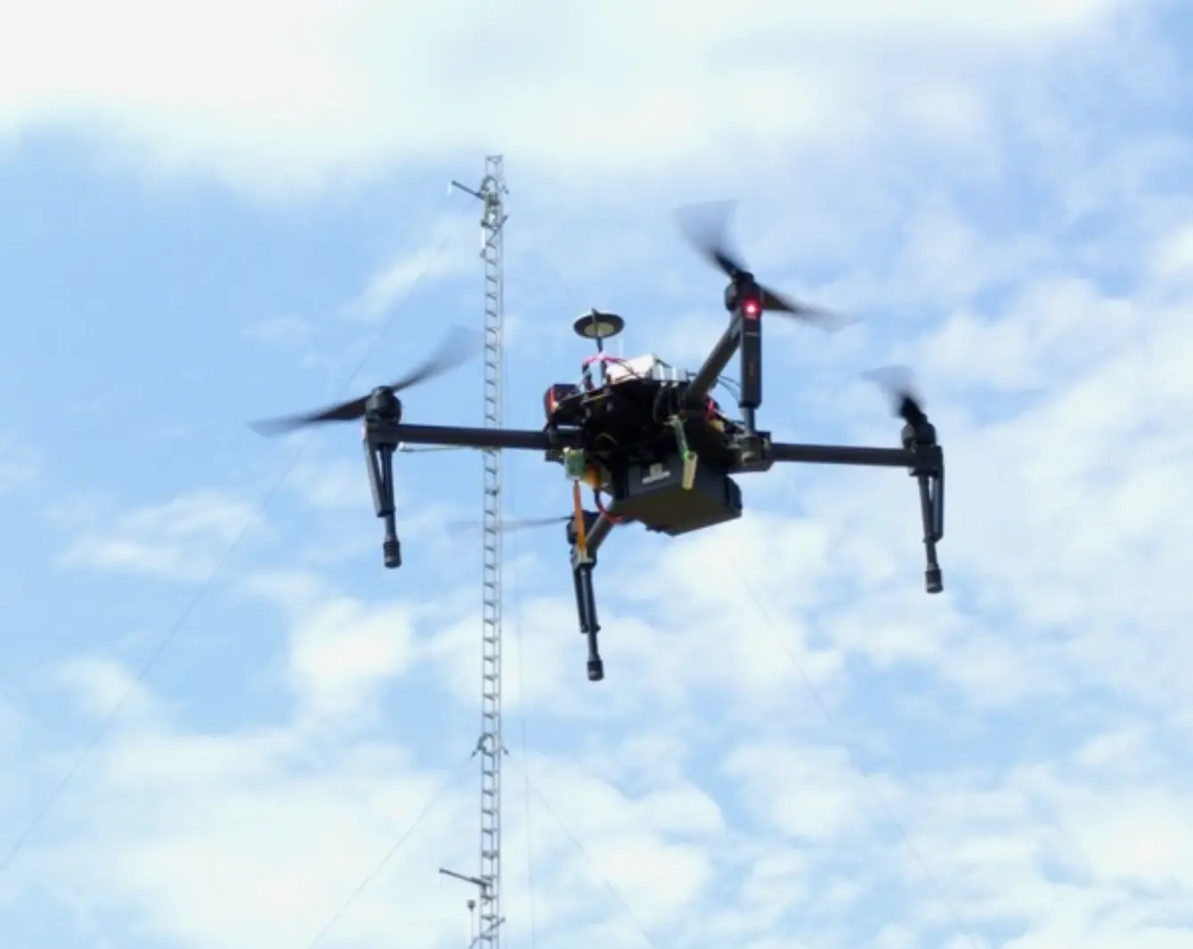
Sparvio – Flexible sensor solutions for UAV missions
Custom projects - Designed around your mission needs
Products & services
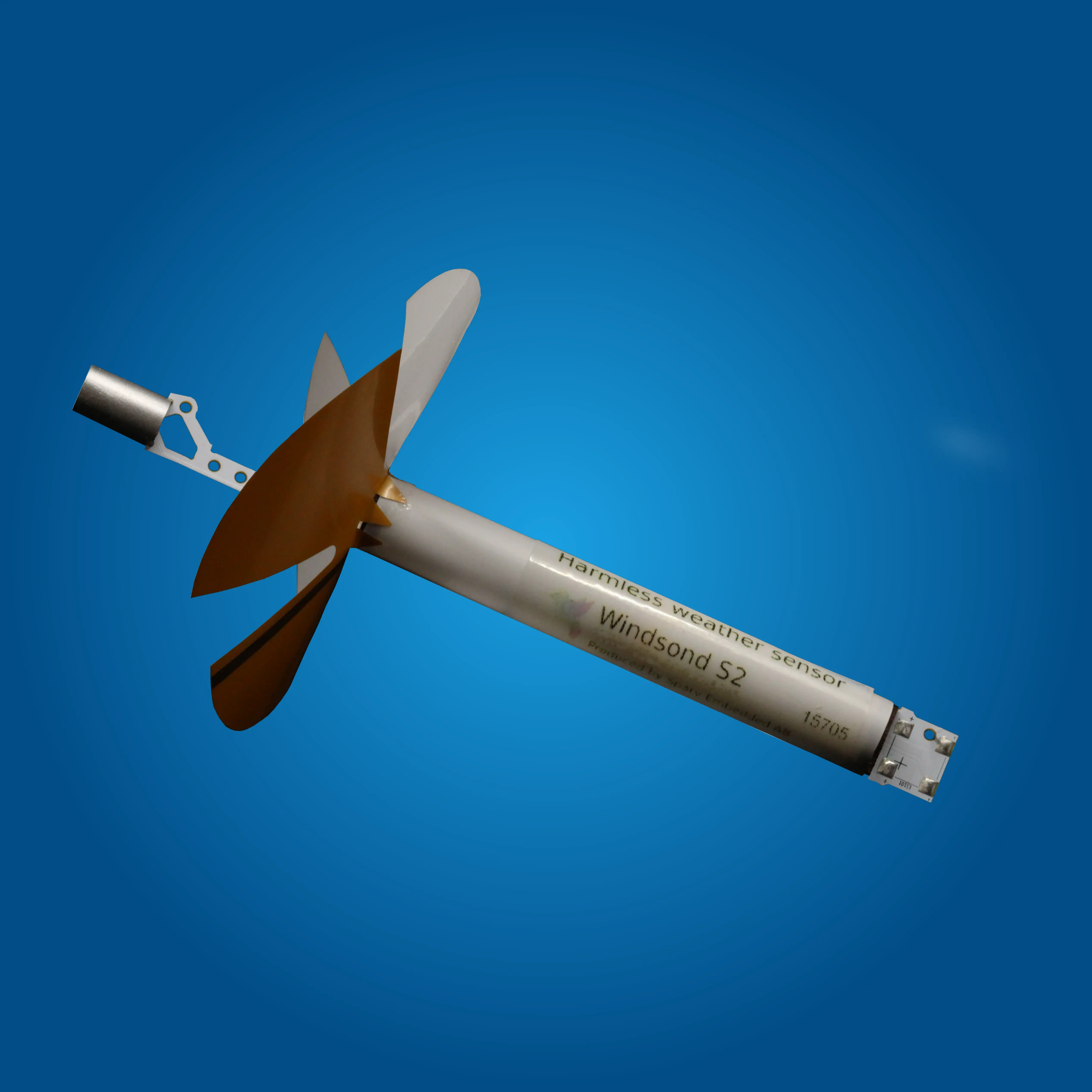
Windsond - Ultra-light radiosondes for better field operations
Custom projects - Designed around your mission needs
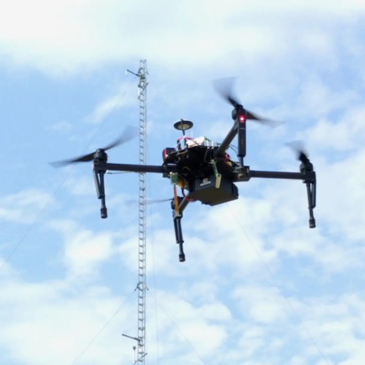
Sparvio – Flexible sensor solutions for UAV missions
Solutions built for your industry
Discover how Sparv’s systems are used across research, defense, wildfire operations, and more.
Insurance & fire prevention
Increase the safety and efficiency of wildfire operations with real-time atmospheric insights. Deploy Sparv’s solutions to track fire behavior, wind shifts, and evolving conditions—helping teams make faster, safer decisions in the field.

Defense
Our radiosondes deliver reliable atmospheric data for mission planning, surveillance, and tactical decision-making. Designed for demanding environments, the military version includes secure communications and system-level integration for defense operations.

Research & education
Whether you’re conducting atmospheric research or teaching the next generation of scientists, Sparv’s measurement systems provide accurate, hands-on data. From classroom experiments to university research and field campaigns, our tools make it easy to explore and understand weather and environmental processes.

Trusted by professionals in the field
Our products are built for demanding missions, but the people who use them every day tell the story best. Here’s how researchers, wildfire teams, and educators around the world rely on Sparv in the field.

Professor Tom Richardson - Faculty of Engineering, University of Bristol
"The staff were brilliant and turned around a last minute request from us in the days leading up to our deployment. Both the company and the hardware are thoroughly recommended"

Marc Castellnou -International Wildland Fire Strategy Analyst
Check how Marc and his team are using Windsond for mapping the behavior of a wildfire in Catalonia.

Timothy B. Keebler - Millersville University
"Our Windsond operations have been a successful endeavor. Our use has been twofold: education in elementary and middle schools, and boundary layer research."

Vincent Graveline - Université de Montréal
"I really liked the software [Windsond Desktop], easy to use and to understand..."
Trusted by professionals in the field
Our products are built for demanding missions, but the people who use them every day tell the story best. Here’s how researchers, wildfire teams, and educators around the world rely on Sparv in the field.
Marc Castellnou -International Wildland Fire Strategy Analyst
Check how Marc and his team are using Windsond for mapping the behavior of a wildfire in Catalonia.
Professor Tom Richardson - Faculty of Engineering, University of Bristol
"The staff were brilliant and turned around a last minute request from us in the days leading up to our deployment. Both the company and the hardware are thoroughly recommended"
Vincent Graveline - Université de Montréal
"I really liked the software, easy to use and to understand..."
Timothy B. Keebler - Millersville University
"Our Windsond operations have been a successful endeavor. Our use has been twofold: education in elementary and middle schools, and boundary layer research."
Meet Sparv at the AMS annual event 2026
Anders Petersson and Johan Gustafsson will be present at the American Meteorological Society annual event 2026. Are you attending too? Let's meet there!

Uncovering Hidden Greenhouse Gas Emissions
This study presents the first multi-plant, full-scale assessment of methane (CH₄) and nitrous oxide (N₂O) emissions from 13 Swedish wastewater treatment plants (WWTPs) using advanced drone-mounted sensors.

Enhancing Lower-Atmosphere Sampling with Windsond S2
Modern weather prediction models now deliver forecasts at finer scales, but the number and quality of in-situ atmospheric observations lag behind, creating a critical “data gap”.
